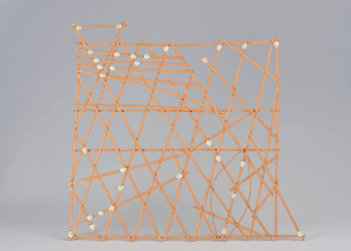
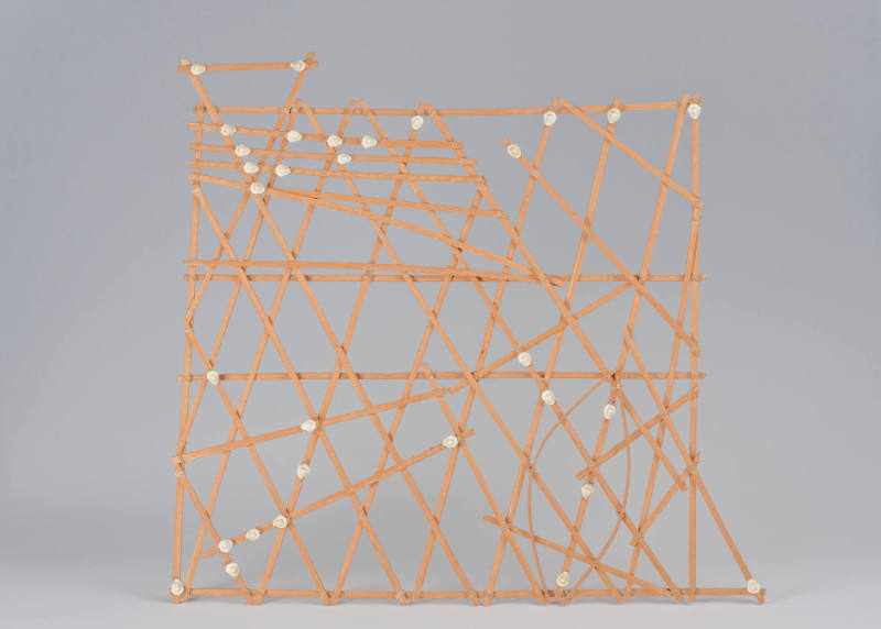
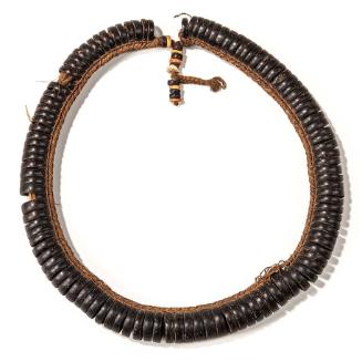
Navigational Chart (Rebbelith)
ClassificationsTools and Equipment-charts
Date20th Century
Made AtMarshall Islands
MediumPalm leaf midribs, fiber and cowrie shell
Dimensions20 1/4 × 21 5/8 × 5/8 in. (51.4 × 54.9 × 1.6 cm)
Credit LineGift of Jesse W. Curtis
Object number97.132.1
DescriptionThe most unique tool used by wayfinders to navigate the long distances between distant islands was the stick chart. Exclusively used by Marshall Islanders, these nautical maps were created by veterans who had already undertaken voyages. They provided a spatial representation of islands and wave patterns mariners could expect to encounter. The charts were not brought on board outriggers but were memorized by navigators before taking to the open seas.This is a star map from the island of Kwajalein in the Marshall Islands. Made of palm leaf midribs, fiber and cowrie shell, it was used as a navigational chart for sea voyages. The Marshall Islands are a Micronesian culture, and this navigational chart contains much of the quintessential knowledge wayfinders brought with them to the ocean. The Marshall Islands contains a total of 1,156 islands, so different charts were made to show the entirety of the islands, smaller chains, or were purely instructional. The cowrie shells and strips of wood represent features such as reefs, islands, and currents, but reading the chart requires very specific knowledge.
On View
On viewCollections


1916-1918
19th Century
1368-1644
early 20th Century